
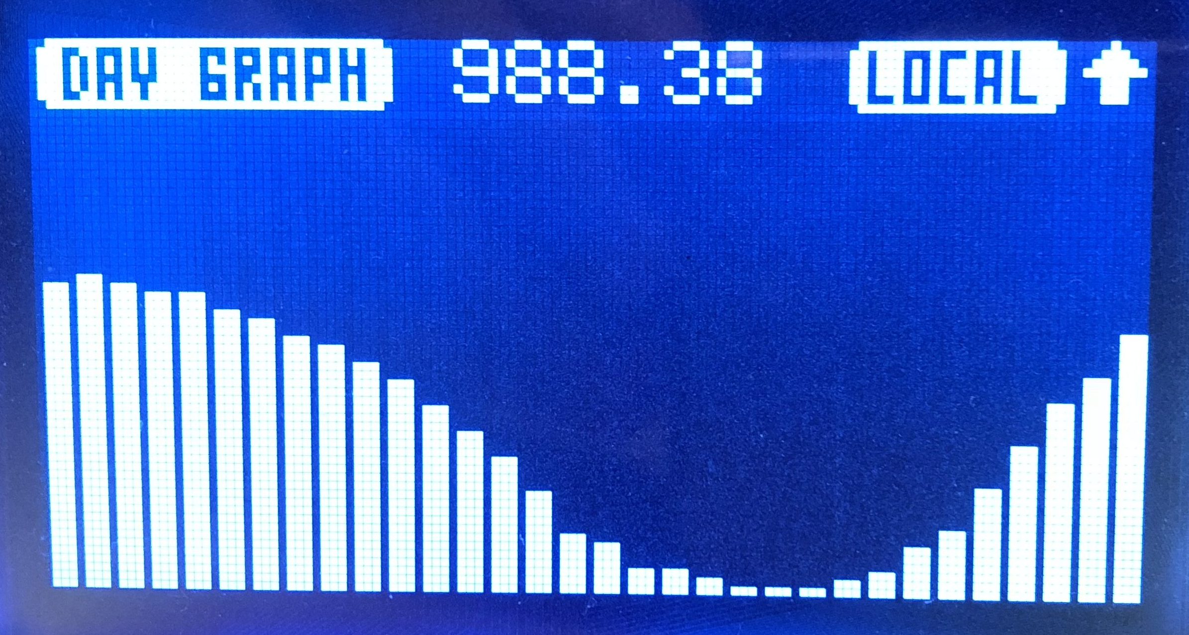
A decent autumn low pressure system moved in over the past 24 hours.* Pressure is heading up now, and it looks to be sunny tomorrow with normal temps (low 60s) for late September.
Autumn is typically when we start seeing big wind storms. Our max gust so far today, Friday, has been 37 mph at 11:30AM. Winds are beginning to slightly trend down as of 5PM.
Find it anytime on our Area page using the “Zone” selector at the top.
Summer Below the Bridge
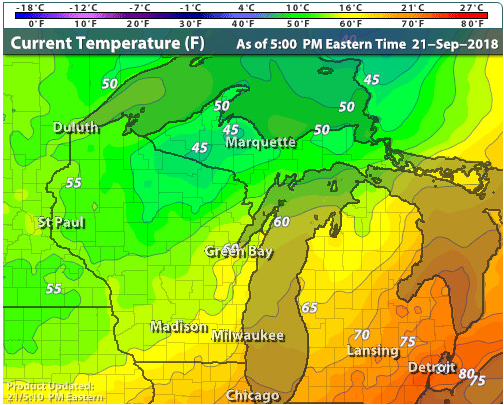
Check out the big spread in temps across the state currently. It’s still in the 80s in parts of Lower Michigan!
Town should escape frost for the most part tonight, but it might be our coldest night since at least 9/9 (low of 44) if not last Spring.
As always, we archive everything we measure on the weather history page. That’s where you can find out what weather is typically like this time of year or what it’s been like in past years.
——
* We hit a minimum sea-level pressure of 29.33″ (993mb) at 7AM this morning. Not a shabby number, but we’ve seen lower.