
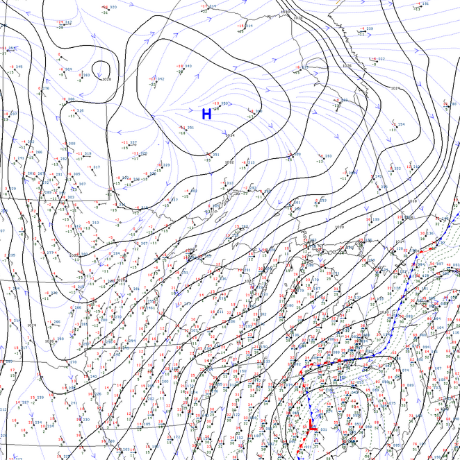
Some may wonder what happened to all the snow that was in last week’s forecasts. Well… this is a story about a cool, dry Canadian high picking a fight with a warm, moist low to the south.
Numerical weather predictions (“the models”) were all over the place in the days leading up to the presumed storm Saturday/Sunday. In the end, the low pressure system with all the embedded moisture ended up tracking further southeast into Lower Michigan. High pressure won the day.
However, northeast winds and cooler temperatures were sufficient to produce some extremely lightweight, low-intensity, lake-effect snowfall. This is snow where you can decide between a shovel and a broom when it comes time to clean up! Gusty winds kept lifting it off our snow boards. We ended up only measuring 0.2″. But our estimate is about 1.5″ of snow fell early Saturday through Sunday afternoon.
An active week to 10 days lies ahead. In particular, a significant storm originating out of the Rockies may head up our way Fri/Sat. Some smaller snow events in between. Also some lake effect to follow, possibly.