We announced late last year that we would no longer measure snowfall. Well, at least not regularly 😉
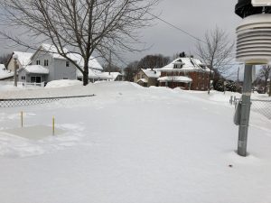
Since we still have a snow board in our observation area — and we had cleared it before it started snowing Friday — we thought we’d stick a ruler down this morning after all was said and done.
Turns out 12.0″ fell in the past 48 hours ending 10 AM Sunday morning. That corresponds to 0.85″ of melted snow (liquid equivalent) that we caught in our precipitation gauge over that period.
Now, take it with a grain of salt because it’s in a somewhat sheltered area that is prone to drifting. However, this spot is lower than some and higher than others. Seems pretty average.
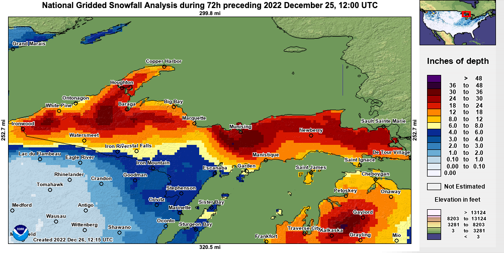
The National Weather Service office in Negaunee Township, just 8 miles up the road on US-41, measured just over 2 feet in that same time period. That is likely due to their higher elevation. Other reports closer to the lakeshore support lower totals such as ours.
In the future, we may provide a storm total measurement after significant events. That’s assuming that nearby drifts don’t expand to include our snow board. That can result from plowed snow mountains up wind growing over the course of the winter.
As far as wind speeds, our max recorded gust was 35 mph out of the north yesterday morning in the 7 o’clock hour. We have good “fetch” from that direction with no obstacles within 100 feet. The U.S. Coast Guard, located near McCarty’s Cove on the lakeshore, caught a 58 mph gust in the 10 AM hour but mostly clocked upper 30s / low 40s gusts throughout Saturday morning.