Updated: Tuesday 12/20/22 11:25 AM
Expect high winds & significant snowfall in the days leading up to Christmas (Fri/Sat).
It’s still too early to discuss exact amounts of snow or top wind speeds. Have the shovels, snowblowers and/or generators ready though.
Decent snowfall likely late Wednesday & throughout Thursday before main event on Fri/Sat.
As of 11:25 AM Tuesday, max winds should occur Friday afternoon thru early Saturday morning. If power should fail, buildings without a backup source of power or heat will cool quickly as temperatures slide into the teens or colder.
This event will encompass a large portion of the Eastern United States. Traveling, may be difficult to impossible. Flights may be significantly delayed or cancelled. Driving visibility, especially near Lake Superior, may be near or at zero sometimes. Reminder: the Mackinac Bridge is subject to closure in high wind & low visibility events.
I intend to measure snowfall throughout the week and post the amounts on the website & social media (Twitter especially: @mqtweather).
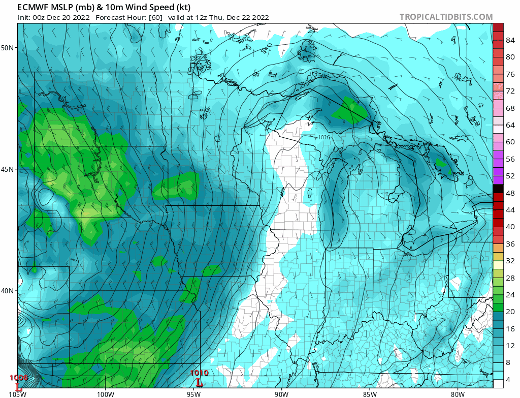
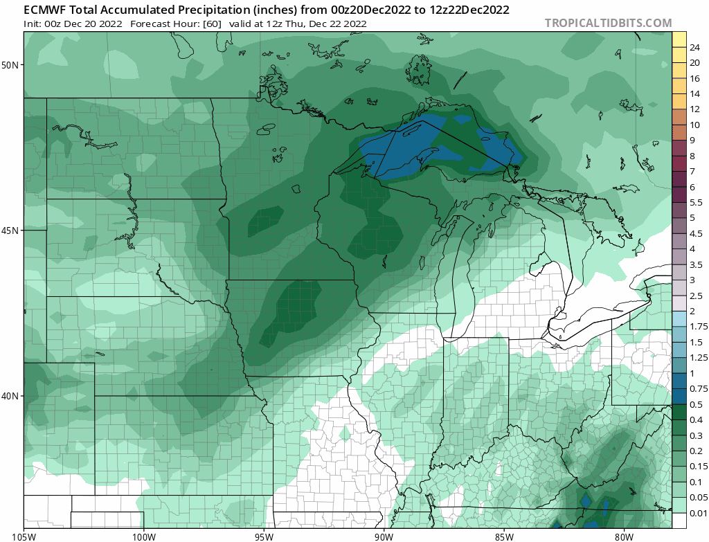
Below are updated GIFs of the European Model. Snowfall totals are trending downward while wind speeds are holding steady. Keep in mind, this is just one (particularly good) model’s projection what may occur 72-96 hours from now. Very much subject to change. Models have been oscillating quite a bit.